August 23, 2025
A step-by-step guide to locating your property’s drainage maps.
Whether you’re planning an extension, trying to solve a recurring blockage, or are simply a curious homeowner, having a map of your drains can be incredibly useful. This plan can show you the layout of the pipes, the location of inspection chambers, and how your home connects to the public sewer.
However, finding a single, perfect “as-built” drainage plan, especially for an older house, can be difficult. The process is often a bit of detective work, piecing together clues from various sources. Here’s a step-by-step guide on where to look.
1. Start with Your Own Paperwork
The first place to check is the collection of documents you received when you purchased your property. You might be surprised what you find. Look through:
The Homebuyer’s Report or Survey: Your surveyor may have made notes or included a basic sketch of the drainage system’s condition and layout.
The Legal Pack & Deeds: The paperwork from your solicitor can sometimes include plans provided by the previous owner, especially if they undertook any extension work.
Paperwork from Previous Renovations: If you have documents from any past extensions or significant building work, the drainage plans submitted to the council at the time should be included.
2. Contact the Authorities and Developers
If your home files don’t have the answers, the next step is to check with official bodies.
Your Local Authority Building Control: Your local council (e.g., Watford Borough Council or Three Rivers District Council) holds records of all planning and building regulation applications. If your home is a newer build or has been officially extended, the drainage plans should be on file here. Be aware that for older properties, these records may be archived and harder to access.
The Local Water Company: Your regional sewerage provider (e.g., Thames Water) maintains maps of the public sewers. They will not have a plan of the private drains within your property boundary. However, their maps are invaluable as they show where your private system connects to the main network, which is a vital piece of the puzzle.
The Original House Builder: If you live in a property on a newer housing estate, the developer might still hold the detailed “as-built” plans for the entire site, including the drainage for each house.
3. The Modern Solution: When the Paper Trail Goes Cold
So, you’ve checked all the records and still can’t find a clear plan. This is a very common situation, but thankfully, there is a definitive, modern solution that is far more reliable than an old paper drawing.
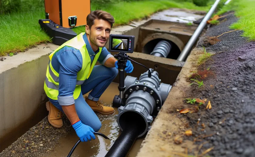
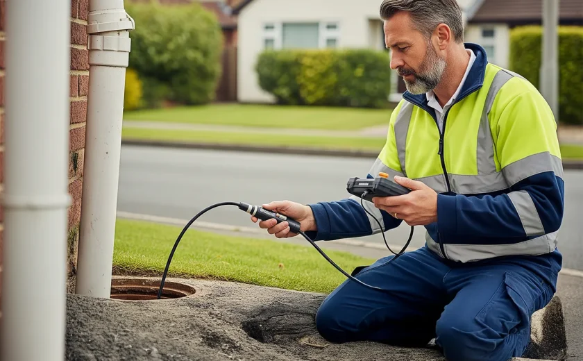
The most accurate way to map your drainage system is with a professional drain mapping.
An engineer will feed a high-resolution, flexible camera directly into your drains. This provides a real-time video feed of the entire network. From this, the engineer can create a highly accurate, up-to-the-minute map of your system, showing:
- The exact location and depth of all pipework.
- The locations of all junctions and inspection chambers.
- How your foul water and surface water are managed.
- Crucially, the current condition of the pipes, identifying any cracks or blockages.
While finding an old plan is helpful, a CCTV drain survey gives you a complete and accurate picture of your system as it exists today, which is essential for any major project.