Building and Extensions
CCTV Drainage Surveys and Autocad Plans for Planning Applications
Before you finalise an extension, a refurbishment or a planning application, you need to know what is underground. A drainage survey for a planning application tells you where the pipes run, what condition they are in, and whether the proposal sits over or too close to a public sewer.
Drain 247 provides specialist CCTV drain investigations, precise drain mapping and condition-coded reports for architects, designers and their clients across London and Hertfordshire. If you already have an AutoCAD site plan, we can update it with accurate underground data. If you do not, we can produce a clear schematic drainage drawing.
When a Planning Application Needs a Drainage Survey
Look at the existing drainage early if you are designing an extension, conservatory or deep refurbishment, preparing drawings for planning or Building Regulations, working out whether a build-over agreement will be needed, or advising a client who has had repeated blockages or flooding.
Planning permission does not, on its own, give permission to build over a sewer or drain. Thames Water, the sewerage undertaker for much of London and south-west Hertfordshire, including Watford, is clear that planning permission does not grant you permission to build over a sewer or drain. If the survey shows a public sewer in or close to the footprint, that needs to be resolved with the water company before the design is frozen.
For the wider rules on extensions in our area, see our guide to Hertfordshire extension drain rules and build-overs.
What a CCTV Drainage Survey Actually Shows
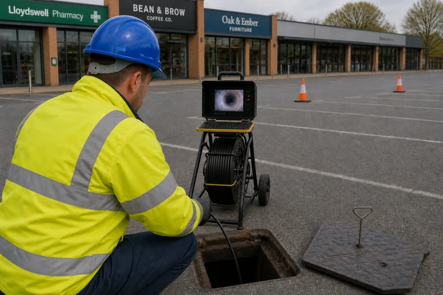
A CCTV drain survey puts a camera through each run so you can see cracks, displaced joints, roots, scale, deposits and collapses, and exactly where they sit. The condition of the pipe is recorded using industry-standard coding, which is the format water companies, building control and insurers are used to reading. You receive the footage, high-resolution photographs of defects and key features, and a condition-coded written report, ready to attach to a submission or to issue to the design team.
Mapping the Layout, Not Just the Condition
A survey answers “what condition is it in?”. A map answers “where does it go?”. For planning and design work you usually need both.
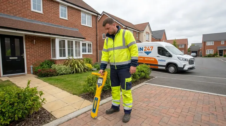
Drain mapping produces a scaled plan of the drainage on the site: the route of each run, cover and invert levels, pipe sizes and materials, flow direction, and where each connection goes. That is what lets you place foundations, a new stack or a garden room with confidence. Our short comparison of drain mapping versus a CCTV survey sets out when to use each, and when to book both on the same visit. If the client has no drawings at all, start with how to find drainage plans for a property, then have the site surveyed and mapped.
Autocad Updates and Schematic Drainage Drawings
We deliver two types of drainage plan.
1. An AutoCAD update of your existing plan. Send us your current site plan and we add our CCTV survey and mapping data directly onto it. The updated plan typically shows depths at every manhole and inspection chamber; junction positions, by distance and clock position; pipe sizes and materials on each run; foul and surface-water flow direction; defects and blockages where the survey could not pass; and a complete legend, on your own base plan.
2. A schematic drainage drawing. If there is no usable CAD file, we produce a clear computerised layout of the existing drainage. That drawing typically shows cover and invert levels at each chamber, pipe sizes and gradients, flow direction, the site boundary and the public sewer in the road, and, where it applies, a run flagged inside a proposed extension footprint.
Plans can also note pipe materials, ownership, and distances to the boundary and to the building. Example drawings are in the flyer alongside this article. The schematic sample is illustrative and does not relate to a real site.
Already have an AutoCAD plan? Email it to info@drain247.co.uk with the site address and a short note on the project. We will add our survey and mapping data directly onto it, and your quote is free.
Build-Over Agreements: What the Survey Is For
In Thames Water’s area, a build-over agreement is likely to be needed for building works to an existing property within 3 metres of a public sewer, or within 1 metre of a public lateral drain. Their developer guidance on working over or near sewers says the same. Other sewerage companies have their own rules, so always check the company that serves the site.
A drainage survey and an accurate plan show the size, material, depth and condition of the pipe, and its position relative to the proposed foundations. Thames Water also asks for an existing and proposed drainage layout and a sectional drawing of the foundations and sewer. We provide the underground evidence; your architect or structural engineer prepares the foundation and construction details. If a manhole sits inside the proposed footprint, or the pipe is in poor condition, the design may need to change, or a diversion may be required, before you apply.
What You Can Expect from Us
We are drainage specialists serving London and Hertfordshire since 1986, fully insured with £5 million public liability and professional indemnity insurance, and fully accredited. Our teams wear PPE at all times. As well as the survey, map and drawings, we can take the job through to cleaning, structural patch lining and a post-repair CCTV check.
We work across London boroughs and Hertfordshire, from our office at 44 Clarendon Road, Watford. Call-backs are typically within a couple of hours. There is no call-out fee.
Email info@drain247.co.uk with the site address, any existing drawings and a short brief, call 01923 959780, or use our contact form. Tell us the deadline if you have one, and whether you need an AutoCAD update or a fresh schematic.
Frequently Asked Questions
Will a Drainage Survey Satisfy the Planning Officer on Its Own?
Not by itself. A survey and a drainage plan give the officer, building control and the water company the facts they need. You will still need the rest of the planning pack and, where it applies, a separate build-over or diversion agreement with the sewerage company. Planning permission does not replace that agreement.
Can You Work from Our Autocad File?
Yes. That is the preferred route. Send us the file with the site details and we will update it with the survey and mapping data. If the file cannot be used, we will produce a schematic drainage drawing instead.
Do I Need Both a CCTV Survey and Drain Mapping?
For a planning application or an extension, usually yes. Mapping shows the layout, levels and connections; the CCTV survey shows the condition. We can do both on the same visit. See our mapping versus survey guide.
How Quickly Can You Turn a Report Around?
We aim for a rapid turnaround. Times depend on the size of the site, access to the chambers and whether an AutoCAD update is required. Tell us your submission date when you enquire and we will say what is realistic before we start.
What If the Survey Finds a Public Sewer Under the Extension?
Do not start construction. Check the water company’s build-over or diversion process and, if needed, adjust the design. Our build-over agreements advice and Hertfordshire extension drain rules set out how that usually works in our area.
Send Us Your Plans
If you have a planning submission that needs a CCTV survey or an AutoCAD update, call Drain 247 on 01923 959780 or email us the drawings. Competitive prices, local engineers and a quick response, with a free quote.